

What Types of Autonomous Marine Platforms Does NOC Use?
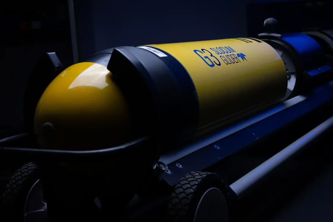
The Glider team at the National Oceanography Centre uses three main types of autonomous marine platforms: Slocum Gliders, Seagliders, and Wave Gliders.
These platforms can gather data on a variety of different oceanographic parameters and provide an opportunity to reach areas and depths that more traditional scientific measuring methods cannot.
How do Slocum and Seagliders Work?
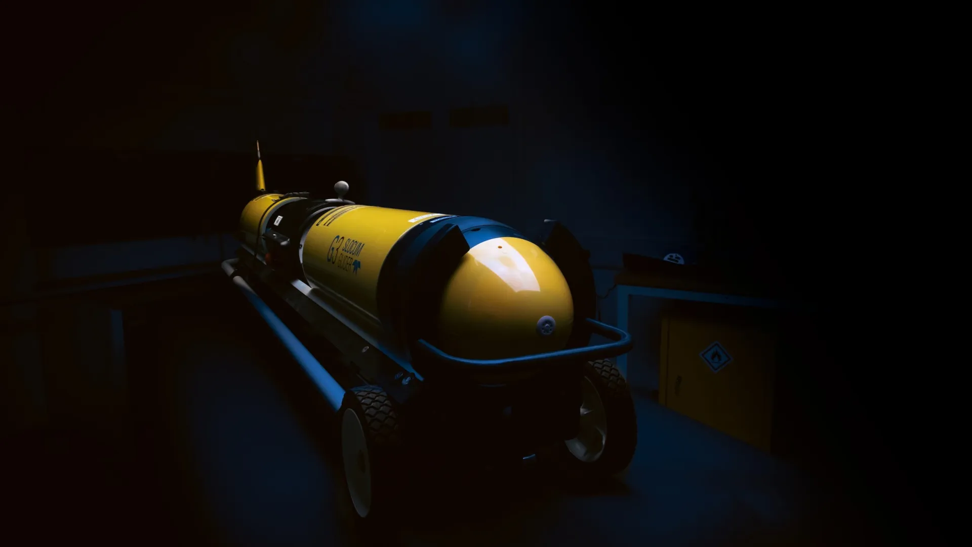
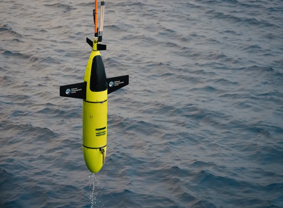
Slocum and Seagliders are autonomous underwater vehicles that move by changing their buoyancy. By pumping fluid in and out of an internal bladder, they sink and rise through the water in a "saw-tooth" pattern. Their wings cleverly convert this vertical motion into forward movement. They pop up to the surface every so often to send back data via satellite and get new instructions.
How do Wave Gliders work?
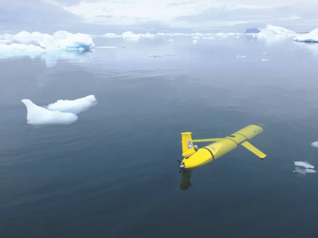
Wave Gliders are surface vehicles which move powered entirely by wave energy. A float sits on the surface, connected to a submerged glider below. This lower part has fins that convert the vertical energy from the waves into forward thrust. Solar panels on the surface float power all the instruments and communication systems.
Why do we use gliders and why are they important?
Simply put, they give us long-duration, cost-effective monitoring that just isn't possible with ships alone.
- Their ability to operate for weeks to months at a time offers continuous, high-resolution data in both space and time.
- This improves our understanding of critical processes like ocean circulation, carbon storage, climate regulation, and ecosystem health.
- By feeding their observations into forecasting models, they strengthen our ability to predict weather, storms, and long-term climate change.
Where are These Technologies Used?
Like the Irish Sea, to monitor tides, fronts, and plankton blooms.
Including the Atlantic and Southern Ocean, for climate and carbon cycle studies.
Such as in storms or ice-covered regions (under sea ice or near icebergs), where it's not safe for ships to operate.
Where Wave Gliders can travel thousands of kilometres measuring atmosphere-ocean interactions.
How do gliders link to other research areas?
Understanding heat and carbon exchange between the ocean and atmosphere.
Tracking plankton blooms, fish, and marine mammals.
Feeding real-time data into Met Office and European climate/weather models.
Calibrating satellite observations of sea surface height, temperature, and chlorophyll.
How do Gliders Enhance and Contribute to Ocean Observation and Regulation?
Gliders allow for continuous, fine-scale monitoring of temperature, salinity, nutrients, and currents. This data is essential for understanding ocean circulation and climate change dynamics.
When equipped with sensors like fluorometers and acoustic recorders, gliders can observe plankton blooms and monitor marine mammals (like whales). This offers critical input on ecosystem health and biodiversity.
Missions near the giant iceberg A-68a uncovered how its meltwater influences nutrient distribution and water layering (stratification) in the Southern Ocean. This data helps us refine and improve our climate models. Slocum gliders also supplied real-time data on ocean heat and salinity during Hurricane Florence. This reinforced weather models and improved storm prediction. It also helped flag areas vulnerable to hypoxia (low oxygen) due to the massive influx of freshwater.
What Would Happen if Gliders Weren't Used?
Big observational gaps would remain, especially in remote or extreme environments. This would hamper our modelling efforts. A lack of long-duration, high-resolution data could lead to weaker forecasts for weather, climate, and marine ecosystem management. Conservation efforts, like protecting whales or managing shipping corridors, would lack real-time data, increasing human-wildlife conflicts and ecosystem risk.
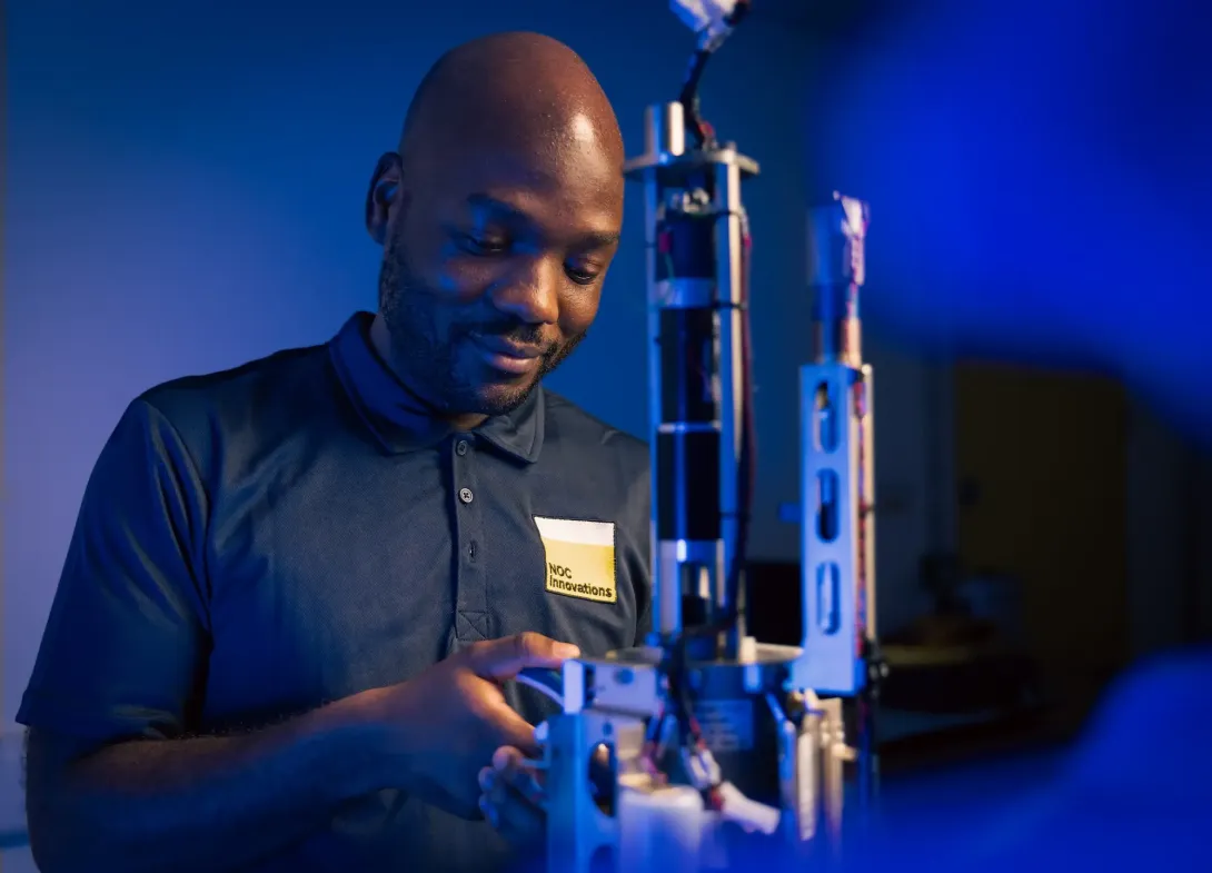
Glider Service Centre
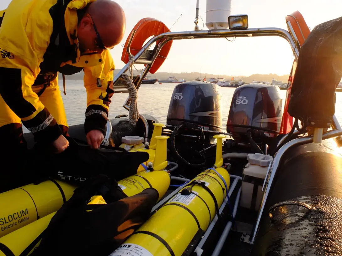
Our Glider Service Centre in Southampton is Teledyne's accredited service centre for Europe. Through NOC Innovations, we provide repair, calibration, training, and upgrades for Slocum Gliders. This offers European clients faster turnaround times, reduced shipping costs, and direct access to local expertise.
Specialised missions like BIOPOLE and Pycnogen involve modifying Slocum gliders with upwards-facing altimeters, positioning systems and enhanced processors. These upgrades allow them to operate under polar ice, pushing the envelope of science into truly harsh environments.
Major Project and Expeditions: Climate
Gliders have played a vital role in a number of projects that aims to learn more about our climate. Whether it's taking measurements of vital ocean systems or visiting areas that conventional methods can't, their importance has resulted in a number of key breakthroughs.
The ReBELS project is helping scientists understand how the ocean locks away carbon in the Labrador Sea, a region vital for regulating Earth's climate. By setting up a year-long observatory using underwater gliders, drifting floats, and moored sensors (all fitted with bio-optical and biogeochemical sensors and cameras), the project tracks how tiny carbon particles sink, mix, or are carried by currents. By following these processes over a full year, something only possible with autonomous platforms, ReBELS is giving us a clearer picture of how the ocean absorbs and stores carbon long-term.
The CUSTARD project is uncovering how changing seasons in the Southern Ocean influence where and how carbon is stored. Using research ships, moorings, and a Slocum glider that operated for over 10 months (NOC's longest continuous autonomous mission), the team collected a full year of data through harsh Antarctic conditions. These observations are revealing how phytoplankton blooms, nutrient cycles, and carbon sinking depths affect the ocean's ability to lock away carbon.
In our Southern Ocean iceberg missions, gliders collected unprecedented in-situ (on-site) data near the giant iceberg A-68a. This was to study how its meltwater impacts ocean layering and nutrient upwelling.
Major Projects and Expeditions: Biodiversity
Life in our ocean play a significant role in ensuring ocean processes continue to function. Gliders are perfect for reaching into some of the most abundant areas of biodiversity and learning all about how they work.
BIO-Carbon is a UK NERC-funded programme exploring how marine life helps the ocean capture and store CO₂. It brings together research vessels, gliders, Bio-ARGO floats, and satellite data to understand key biological processes, like how plankton, viruses, and microscopic animals transform organic matter. It's also looking at how shifts in these processes might affect carbon storage as the climate changes. BIO-Carbon aims to provide more accurate models of ocean carbon storage to help inform climate policy and support net-zero goals.
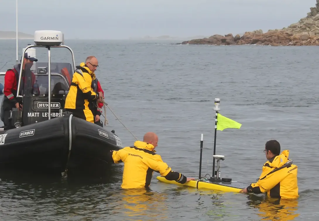
In a landmark mission, seven marine drones were launched from the Isles of Scilly to track plankton fronts and marine life (like dolphins and seabirds) across the Atlantic-Channel boundary. This mission showcased integrated biological and physical monitoring.
Major Project and Expeditions: Sustainable Marine Economy
In order to allow industry to work with the ocean, research needs to be undertaken to ensure every aspect of it is protected. Gliders can be used to produce data and information on the feasibility of industry proposals and plans.
The eSWEETS3 project aims to understand the effect of floating offshore wind farms in shelf seas. These regions are vital for fisheries, marine life, and carbon storage. By combining research ships, underwater sensors, fibre-optic cables, satellites, and computer models, scientists are uncovering how turbines change water mixing, nutrients, and oxygen levels. The results will help ensure offshore renewable energy and healthy oceans can thrive together.
Alongside Newcastle University, NOC developed GNSS-equipped Wave Gliders capable of pinpointing sea-surface height within ±3 cm. They were deployed in Loch Ness (2013), the North Sea (2016), and on an Antarctic-Falklands transit (2017-18). They support satellite altimeter calibration and long-term ocean monitoring.
Research Outcomes
Data from the A-68a iceberg mission shed light on how meltwater destabilises stratification (layering) and enhances nutrient mixing, which is critical information for Southern Ocean models.
Glider-based acoustic monitoring has supported dynamic protective measures for North Atlantic right whales, helping to inform area management and policy.
Glider data collected during hurricanes has significantly enhanced our physical understanding of storm development zones, which in turn improves forecast reliability.
The GNSS Wave Glider's precise sea-level data have refined satellite calibration near coasts and strengthened remote sensing validation.
Mission planning systems developed (for areas like the Newfoundland-Labrador Shelf) have fed glider data directly into ocean current and climate models, supporting better forecasting frameworks.
The Science Gliders Enable
Gliders provide support a range of different research projects and research. NOC works across ocean science and research that aims to help every living thing on the planet flourish.